Discover the Benefits of Using AirNav RadarBox's Firehose API and Data Analytics Solutions
- airnav-radarbox
- firehose-api
- api
- flight-tracking
- flight-data
- aviation
- solutions
- b2b
- airlines
- companies
- airports
- blog


AirNav RadarBox Firehose API solutions page displayed on the screen
The Firehose API & Data Analytics tool is AirNav's enterprise-level API, which includes over 100 data fields such as Call Sign, Speed, Altitude, and Log, among other data fields. This data is available in popular formats such as JSON, XML, and CSV.
Read about our complete API series at https://www.radarbox.com/blog?tags=api
RadarBox Firehose API was designed especially for entities & developers looking to access a large volume of flight data seamlessly.
Why choose AirNav RadarBox Firehose API?
- Multiple Data Sources - ADS-B, FAA SWIM, Oceanic, MLAT, Satellite ADS-C, HF ADS-C & Satellite ADS-B.
- 24x7 Support Free - round-the-clock customer support.
- Easy Integration - Hassle-free integration into the client application.
- Scalable Lower cost - Scalable, data access solutions for customers looking to develop and grow.
1. Airport Movement Statistics
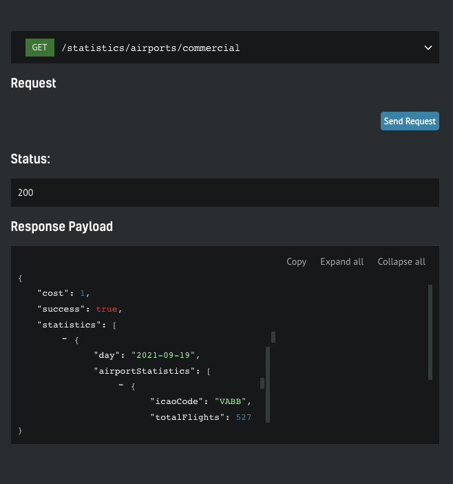
The Image Above: Screenshot of the API Documentation page
In the example above, a data request was made to the Chhatrapati Shivaji Maharaj International Airport (BOM/VABB) for September 19. According to the payload's response, 527 flights were recorded on that day.
2. NAT (North Atlantic Tracks)
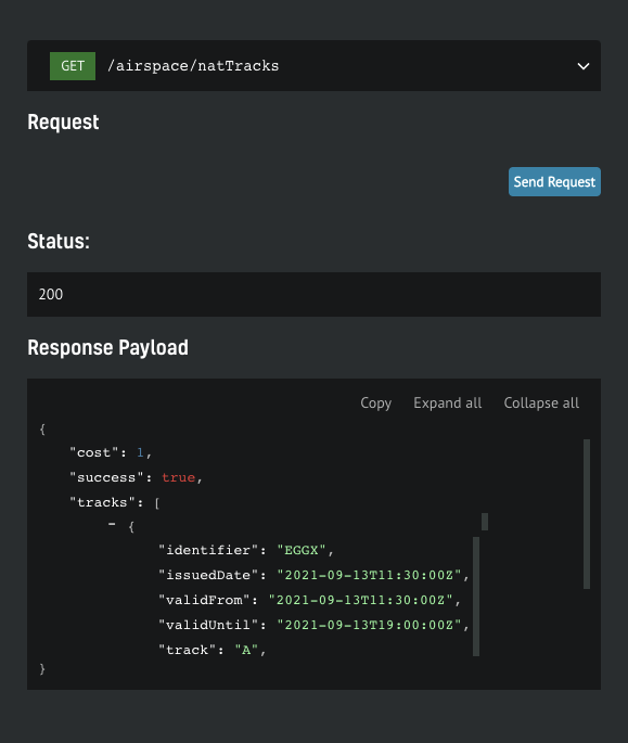
Screenshot of the API Documentation page
The North Atlantic Tracks (NATS) are high-altitude routes across the Atlantic between Europe and North America, which are updated daily.
3. Flight statistics for airlines
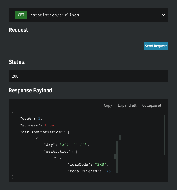
Screenshot of the API Documentation page
With RadarBox's Firehose API, you can also get airline data for a given time period. Jet2 (registered with IATA code - EXS) recorded 175 flights on September 28, 2021.
Among the data solutions, we provide airspace data, airport data, flight statistics, flight and aircraft data - including more than 24 search options and over 100 data fields.
- Scheduled and Actual Departure / Arrival Time
- Flight Number, Callsign, Aircraft type, Speed, Altitude, Registration, Heading
- Origin & Destination and Latitude & longitudes
- Detailed Airport Information
Data Formats
Our data is available in JSON or XML format, and occasionally CSV format. However, data can be provided in multiple formats based on customer preference and requirements.
Coverage
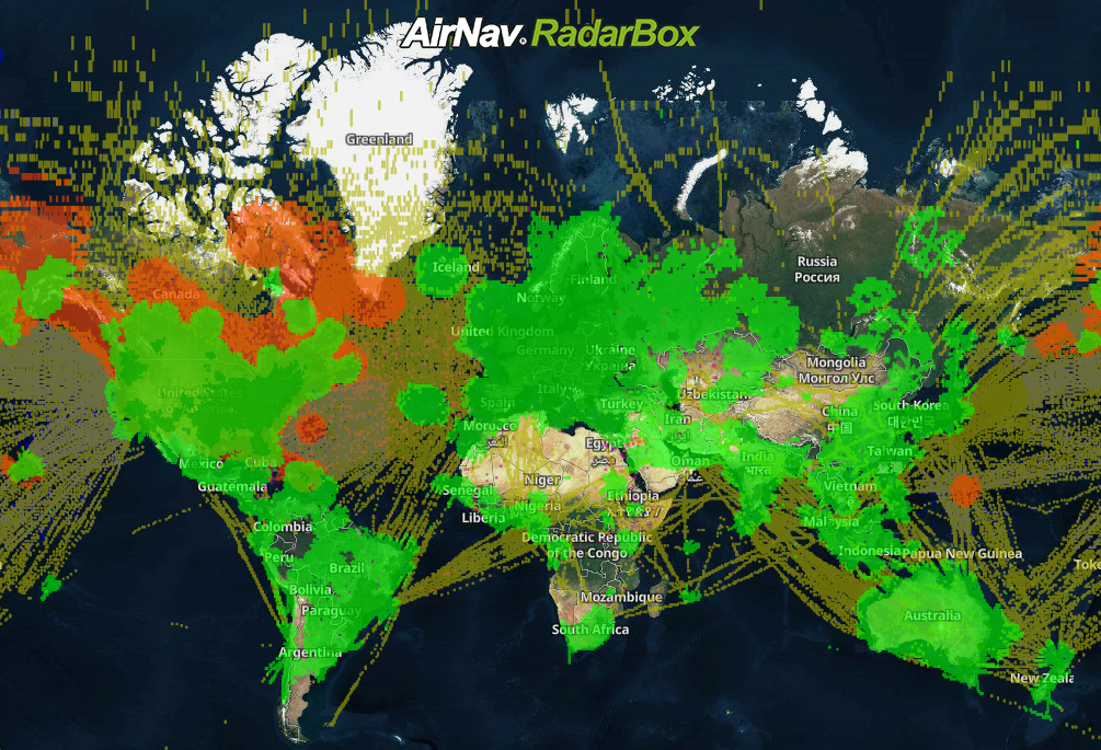
AirNav RadarBox Global Coverage Map
AirNav RadarBox ensures the reliability and accuracy of its services by aggregating data from 14 sources. These sources include Satellite-Based ADS-B data and terrestrial sources such as MLAT, FAA SWIM, Euro Control, and Datalink.
Our data sources include:
- 1 - ADS-B (Satellite-based)
- 2- ADS-B (Ground-based)
- 3 - FAA SWIM
- 4 - Eurocontrol
- 5 - MLAT
- 6 - ADS-C
- 7 - HFDL
- 8 - CPDLC
- 9 - FLIFO
- 10 - ASDE-X
- 11 - FLARM
- 12 - Australia ANSP
- 13 - Oceanic
- 14 - Merged
Data Analytics
AirNav RadarBox Business Intelligence and Data Analytics solutions help companies obtain flight data reports for a wide range of applications, including asset and risk management, competitor analysis, noise monitoring, fleet management, and post-flight monitoring.
Documentation & Information
For more information on documentation, pricing, downloading our client SDK, and data sources, please visit - https://www.radarbox.com/api/documentation
If you are only looking for information on how to get started, we have covered it in a blog post.
For any questions or information, please email us at support@airnavsystems.com or call us at +1 800-401-2474 to discuss the best flight data and tracking solution for you.